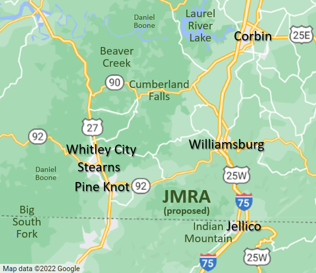
JMRA
This map shows how JMRA could “close the loop” to create an outdoor recreation destination in southern Kentucky along the I-75 and US-27 corridor:

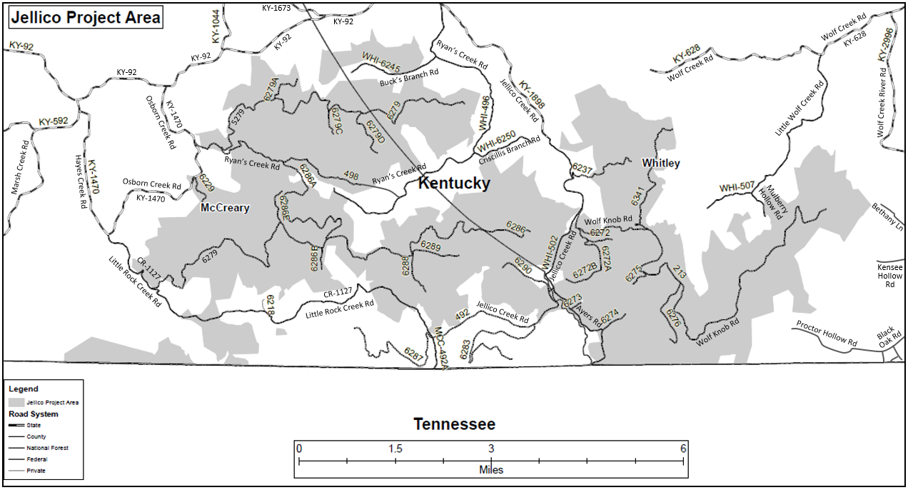
Jellico Mountains
Here is the Jellico Mountains portion of the Daniel Boone National Forest, which would be part of JMRA:
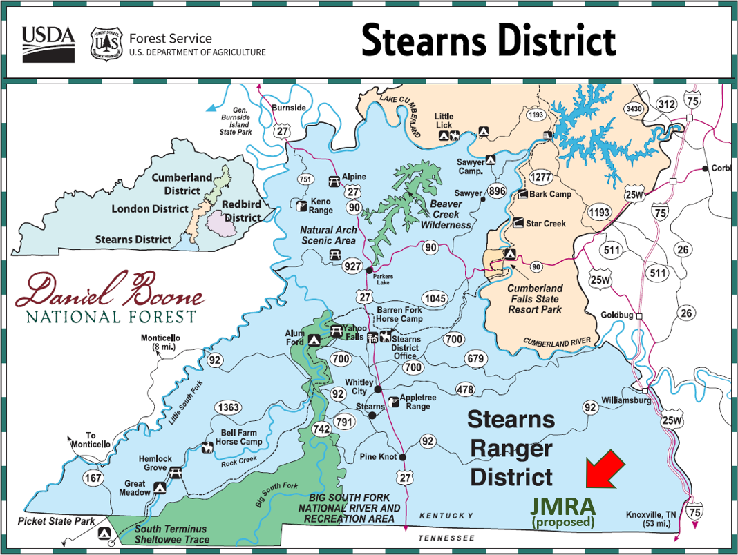
Stearns District
This U.S. Forest Service map shows how JMRA fills a big hole in the Stearns Ranger District of the Daniel Boone National Forest:
OFFICIAL U.S. FOREST SERVICE MAPS
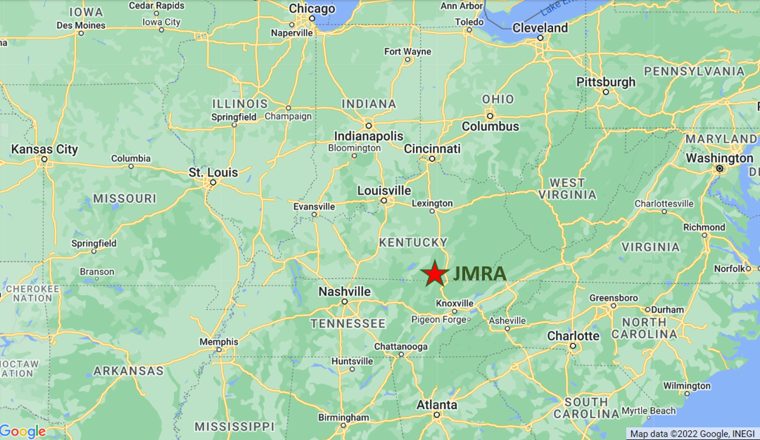
Region Map
JMRA is a short drive from many major cities, including Asheville (3 hours), Atlanta (4.5 hours), Charleston (4), Charlotte (5), Cincinnati (3), Columbus (5), Huntsville (4.5), Knoxville (1), Indianapolis (5), Lexington (2), Louisville (3), and Nashville (4).

All images on this website are copyright their respective owners and published here with permission or license. Please see the Copyright page for more information or to report a copyright issue.
Image Credits:
> Arrows – by OpenClipart-Vectors – pixabay.com/vectors/arrow-button-right-next-forward-153644/
> Divider – by Gordon Johnson – pixabay.com/users/gdj-1086657/
> Jellico Mountains Portion – by U.S. Forest Service with mods – www.fs.usda.gov/Internet/FSE_DOCUMENTS/stelprdb5276519.pdf
> JMRA and Region Map – by Google Maps with mods – www.google.com/maps
> Stearns District – by U.S. Forest Service with mods – usfs-public.app.box.com/s/9j0w2r1potkn5sbokbdyue4wz7wigan9