Daniel Boone
Daniel Boone National Forest (DBNF) contains 708,000 acres of national forest system lands within a 2.1 million-acre proclamation boundary. DBNF sports rugged terrain, steep forested slopes, sandstone cliffs, and narrow ravines. With over 600 miles of trails, two federally recognized wilderness areas, and more than 250 recreation sites, DBNF provides countless opportunities to explore eastern Kentucky’s landscape, heritage, and culture.

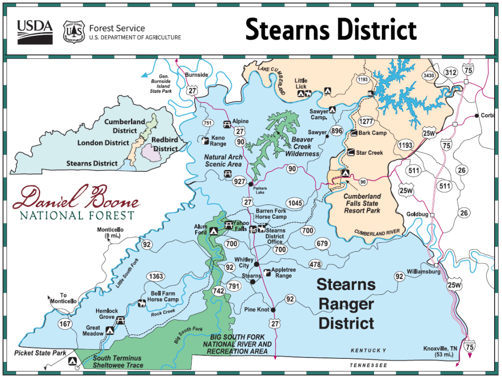
Stearns District
The Stearns District of the DBNF contains 171,000 acres of national forest land in four counties of southeastern Kentucky. Much of the district lies within the Big South Fork region of the Cumberland River, located in the remote foothills of the Jellico Mountains. Steeply-sloped ridges and narrow ravines characterize the land. The terrain is rugged but scenic.
Visitors can enjoy camping, hiking, fishing and other outdoor recreation opportunities. Three campgrounds, three picnic areas, and 120 miles of trails provide for multiple outdoor activities. Dense hardwood forest, cascading waterfalls, and towering sandstone cliffs are some of the area’s best natural attractions.

All images on this website are copyright their respective owners and published here with permission or license. Please see the Copyright page for more information or to report a copyright violation.
Image Credits:
> Arrows – by OpenClipart-Vectors – pixabay.com/vectors/arrow-button-right-next-forward-153644/
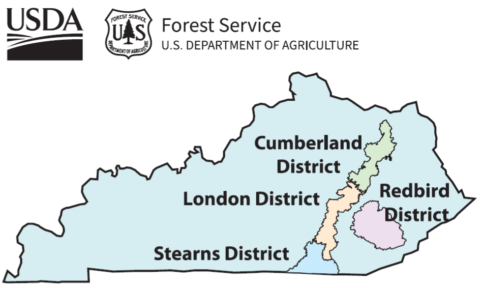
> DBNF Districts – by U.S. Forest Service – usfs-public.app.box.com/s/ntu1mugo5pwrdzelnsq0f43zt6csdsxf
> Divider – by Gordon Johnson – pixabay.com/users/gdj-1086657/
> Stearns District – by U.S. Forest Service – usfs-public.app.box.com/s/9j0w2r1potkn5sbokbdyue4wz7wigan9